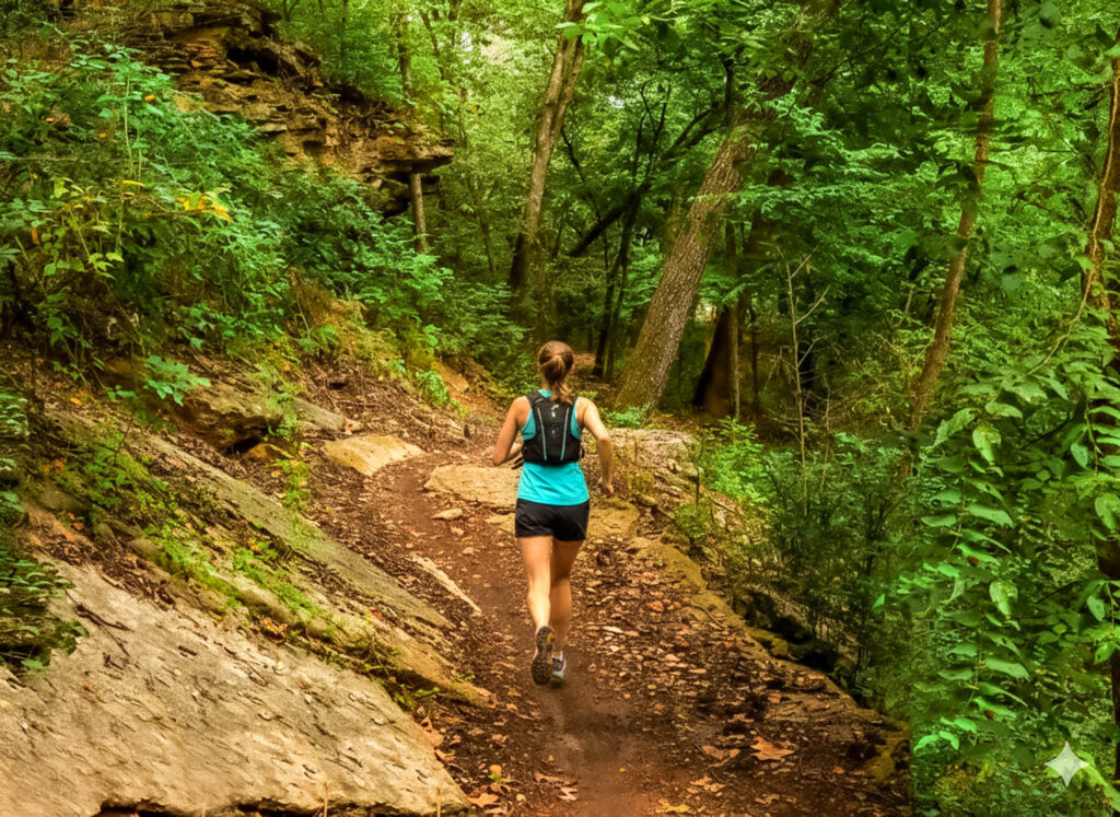
Intermediate trail runs in Bella Vista

Bella Vista gives trail runners a satisfying mix of wooded hills, rocky singletrack, and scenery worth slowing down for. The Back 40, Blowing Springs, and Little Sugar trail systems offer opportunities to explore on foot throughout the community, with enough variety to keep a weekend of running interesting.
For this guide, “intermediate” means you already have some experience running on uneven ground and are comfortable with hills. A five-mile trail run can feel considerably different from five miles on pavement, so choose your outing by terrain and climbing as well as distance.
These four options offer a useful starting point. Distances are approximate, and the linked maps will help you follow the intended route.
Down Under: A Rolling Run Through Little Sugar
Distance: About 5 miles
Start: Old Rock Tank trailhead, near Cedar Crest Drive and Cunningham Drive.
Down Under is a good introduction to the hills of the Little Sugar system. Climbs and sweeping descents keep the effort changing, giving runners a chance to work on pacing uphill and staying controlled on the way down. Discover Bella Vista lists the trail as intermediate for mountain biking; runners should expect a workout with plenty of elevation changes.
Follow the main Down Under loop using the Little Sugar trail map and information. Connections to other trails offer opportunities to extend the outing, but check the complete distance before adding them. Nearby trail names can look deceptively close together on a map.
Lake Ann, SBAT, and Taylor Homestead: A Varied Back 40 Outing
Distance: About 6.3 miles
Start: Lake Ann Trailhead, 1 Wem Lane, off Castleford Drive.
For a defined route on Bella Vista’s east side, follow Hike NWA’s Lake Ann SBAT & Taylor Lollipop. This mapped outing combines the Lake Ann Connector, Pinyon Creek, SBAT, Taylor Homestead, and portions of the Back 40. Its “lollipop” shape means you follow an approach trail, complete a loop, and return along the approach.
Hike NWA rates this natural-surface route moderate for hiking, making it a useful option to consider if you are comfortable running hills and negotiating uneven footing. Save the route before leaving the parking lot: several named trails and junctions make navigation part of the outing. Give yourself permission to walk a rough section and enjoy the woods between efforts.
Tanyard Creek, Play Thru, and Tunnel Vision: Waterfall Scenery and Extra Miles
Distance: About 4.9 miles
Start: Tanyard Creek parking area, 44 Tanyard Drive.
Tanyard Creek can be the beginning of a longer outing. Hike NWA’s Tanyard Creek to Play Thru & Tunnel Vision route links the creekside trails and Waterfall Trail with portions of Tunnel Vision, Lago Vista-East, and Play Thru. The mapped loop follows mostly natural surfaces, with some paved sections.
This is an appealing choice when you want creek and waterfall scenery along with a substantial run. Around the waterfall, bridges, and narrower paths, slow down and leave room for people walking or stopping for photographs. Once you continue onto the connecting trails, settle into a pace that leaves something in reserve for the hills.
Blowing Springs: Choose Your Distance Among the Bluffs
Distance: Flexible; the park’s trail network contains approximately 6.3 miles of natural-surface trails
Start: Blowing Springs Park, 700 Blowing Spring Road.
Blowing Springs brings together rolling trails, limestone bluffs, springs, and rocky stretches that reward attentive footing. The POA allows hiking on these shared trails, and the park also connects with the Back 40, giving runners room to extend their outing.
Choose your circuit using the Blowing Springs trail maps before setting off. The network’s total mileage describes the trails available; your run’s distance will depend on the branches and connections you follow. It is a good place to build an outing around the time and energy you have, with plenty of reasons to pause and look around.
Planning a Longer Run
For a 10- to 15-mile training day, use a current map to select a complete route through the Back 40 or Little Sugar systems. Both offer extensive networks and connecting trails, but the total distance and climbing depend on the exact route. Check every connection, road crossing, and return leg before heading out.
An out-and-back on an appropriate shared trail can also simplify a longer outing: choose your turnaround point in advance and keep enough energy for the return.
Before You Head Out
The City of Bella Vista lists public trail hours as 5 a.m. to 10 p.m. Check current conditions and respect posted closures, which can occur for maintenance, construction, or events. Wet, stormy, and winter weather call for extra judgment.
These are shared trails. City etiquette directs mountain bikers to yield to other users and downhill traffic to yield to uphill traffic. Stay alert, communicate when passing, and keep your hearing clear enough to notice approaching trail users.
Choose routes that avoid dedicated downhill bike lines. Flo-Ride’s downhill section near Lake Ann, for example, carries a specific warning about descending cyclists. Bring water, a snack, suitable shoes, and a downloaded route map.
Stay Close to Your Next Run
Make a weekend of it with a Bella Vista vacation rental. Options include homes for couples, families, and groups, with locations near the trail systems. Look for the features that make your running trip easier: a kitchen for an early breakfast, laundry facilities, and space to relax afterward. Confirm the property’s actual trail access before booking.
Browse Bella Vista stays on Airbnb or Bella Vista vacation rentals on Vrbo. Choosing a home near the trails you plan to explore can make an early start especially easy.
Where to Eat After Your Run
Refuel with breakfast or brunch at Little Sugar Bistro, settle into a casual meal at BV Bar & Grill, or make dinner part of the trip with waterfront dining at Lakepoint Restaurant. All three welcome the public.
At Blowing Springs, Gear Garden offers a seasonal outdoor gathering place, with drinks and a rotating food-truck lineup. Check its current schedule and food availability before making plans. For more choices, browse the Bella Vista dining guide and find a spot for a leisurely meal after your miles.