
• November 16, 2026

Tanyard Creek · Bella Vista, Arkansas

One of Bella Vista’s favorite stops.

Come for the waterfall, then leave a little time for the creek. Tanyard Creek combines some of Bella Vista’s prettiest scenery with easy parking, a picnic area, and short walking options. It is a natural choice for a family outing, a photography stop, or a quiet walk together.

  • Easy parking
  • Restrooms
  • Picnic area
  • Public walking trails

Planning a visit? Browse the Bella Vista Getaway Guide 2027.

The main attraction

The falls and the creek

Waterfall views · Photography · Time together

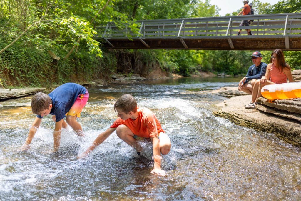
The waterfall below Lake Windsor is the best-known view, but the creek deserves some attention, too. Water moving over rock shelves, reflections, and wooded banks give you plenty to photograph without planning a long hike.

For softer light and a quieter visit, try an early weekday morning. With fewer people around, the creek can be a lovely place for a quiet, romantic walk. Water flow varies with weather and lake conditions.

Children are drawn to the water, but wet and algae-covered rocks can be very slippery. Stay close to young children, wear shoes with good grip, and avoid climbing or sliding on the falls. Follow posted signs and stay out of high or fast-moving water.

An easy place to start

Parking, picnics, and a break

Nature Trail Lane, off West Lancashire Boulevard

Head to the Tanyard Creek Nature Trail parking area. A picnic pavilion and permanent restrooms are near the trailhead, so it is easy to settle in before or after your walk. Coffee or snack trucks may be operating nearby; availability varies.

The nature trails are open to the public. For a group gathering, check the POA’s pavilion reservation rules.

Walking and riding

Choose the right trail

Paved walking loopAbout 0.3 mile · Walking only
A relatively level loop near the parking area. This is the simplest option for a short stroll, but it does not reach the waterfall.
Nature paths to the fallsNatural surface · Walking only
Follow the signed walking paths for the waterfall and creek. Expect uneven ground and some slopes. You can make the falls your main stop or continue exploring; check the POA map before choosing a longer loop.
Tunnel Vision & Lago Vista EastLittle Sugar · Shared by bikes and hikers
Riders can include the falls area in an outing on these nearby trails. Follow the designated bike routes and use the current Little Sugar map for connections. Keep bikes off the walking-only nature trails, yield to walkers, and stop clear of the trail for photos.
Tanyard Creek visitor orientation map Simplified walking area in the orientation of the POA source map, with its north arrow angled toward the upper left, showing parking and visitor facilities northwest of the waterfall, the paved walking loop near the entrance, natural walking paths along Tanyard Creek, and Lake Windsor below the dam. A separate inset shows Lago Vista East and Tunnel Vision in the Little Sugar network. The nature paths are for walking; the Little Sugar trails are shared by hikers and mountain bikers. This is an orientation guide, not a navigation map. BELLA VISTA, ARKANSAS Tanyard Creek Waterfall, creekside walks and a place to pause. Paved walking path Natural walking path Shared bike / hike WALKING AREA Nature paths: no bicycles Nature Trail Lane W. Lancashire Blvd. / AR 340 Lake Windsor Tanyard Creek Lake Windsor Dam P Start here Parking Restrooms Picnic pavilion Paved loop About 0.3 mile Naturalwalking paths Uneven groundand slopes Creekside walking paths Tanyard Creek Falls N The paved entrance loop does not reach the waterfall. ARRIVING ON LITTLE SUGAR Use signed shared trails to reach the Tanyard Creek area. Follow on-site signs where bike and walking routes meet. Lake Windsor Lago Vista East Tunnel Vision Shared bike / hike routes Tanyard Creek area Orientation only - not to scale Use the POA walking map and OZ Trails' Little Sugar map for route detail. Sources: Bella Vista POA Tanyard Creek map; OZ Trails Little Sugar map. Original visitor graphic for Discover Bella Vista / BVGuides.com • Prepared November 2026
Visitor orientation based on POA and OZ Trails maps. Routes are simplified; use the official maps and signs for navigation. The Little Sugar inset shows the surrounding riding area separately from the walking paths.
Enlarge the map

Scroll within the map to see the details. Tap “Enlarge the map” again to close it.

Tanyard Creek visitor orientation map Simplified walking area in the orientation of the POA source map, with its north arrow angled toward the upper left, showing parking and visitor facilities northwest of the waterfall, the paved walking loop near the entrance, natural walking paths along Tanyard Creek, and Lake Windsor below the dam. A separate inset shows Lago Vista East and Tunnel Vision in the Little Sugar network. The nature paths are for walking; the Little Sugar trails are shared by hikers and mountain bikers. This is an orientation guide, not a navigation map. BELLA VISTA, ARKANSAS Tanyard Creek Waterfall, creekside walks and a place to pause. Paved walking path Natural walking path Shared bike / hike WALKING AREA Nature paths: no bicycles Nature Trail Lane W. Lancashire Blvd. / AR 340 Lake Windsor Tanyard Creek Lake Windsor Dam P Start here Parking Restrooms Picnic pavilion Paved loop About 0.3 mile Naturalwalking paths Uneven groundand slopes Creekside walking paths Tanyard Creek Falls N The paved entrance loop does not reach the waterfall. ARRIVING ON LITTLE SUGAR Use signed shared trails to reach the Tanyard Creek area. Follow on-site signs where bike and walking routes meet. Lake Windsor Lago Vista East Tunnel Vision Shared bike / hike routes Tanyard Creek area Orientation only - not to scale Use the POA walking map and OZ Trails' Little Sugar map for route detail. Sources: Bella Vista POA Tanyard Creek map; OZ Trails Little Sugar map. Original visitor graphic for Discover Bella Vista / BVGuides.com • Prepared November 2026

Keep dogs leashed, stay on marked routes, and respect closures. See POA trail details and the City’s trail etiquette.

A reason to slow down

Watch for bluebirds

Look for bluebird nest boxes along the paved walking trail. Volunteers with the Bella Vista Bluebird Society maintain and monitor boxes in the nature area and throughout the community. Watch from a little distance and leave the boxes undisturbed.

Stay and dine in Bella Vista

Make time for a meal together and another day outside.

Find a place to stay

Add your dates and guests, then check the map for the Bella Vista location that works for your plans.

Find something to eat

Browse restaurants and grocery stores at Bella Vista Eats for a meal out or picnic supplies.